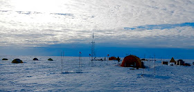
In the austral summer of 2012-2013 scientists and support
staff spent six weeks camped on Antarctica’s Pine Island Glacier. Our fieldwork was part of a collaborative research project titled Ocean-Ice Interaction in the Amundsen Sea: the Keystone to Ice-Sheet Stability.
Planning session at McMurdo
Station with Martin
Truffer, Einar Steinarsson,
and Bob Bindschadler.
 Flying
over the chaotic shear zone created by tension between the rapidly moving Pine Island Glacier and the relatively static West
Antarctic Ice Sheet.
Dale
Pomraning, Hot Water Driller Extraordinaire
Galley Tent at Drill Camp A
Oceanographer Bill Shaw helping drill a 400+ meter deep hole through the Ice Shelf.
Tim Stanton, Bill Shaw and Jim Stockel of the Navel Postgraduate
School deploying an automated ocean profiler below the glacier.
 Geophysicist Leo Peters and
mountain guide Einar Steinarsson
take seismic measurements to study the shape of the ocean cavity and the
properties of the bedrock under the ice shelf.
Einer manually generates a seismic event.
Celebrating succes at Drill Camp A
Leftover mud from a sediment core provides a Pine Island Glacier Facial.
Moving 10-meters a day the 37-mile long ice shelf is chaotic mass of broken ice.
Leo and Einer complete another day of helicopter supported seismic work.
 Extreme pRES technician Mike Shortt of the British Antarctic Survey uses radar-based
ice thickness measurements to determine melting rates on the underside of the
PIG Ice Shelf.
Forrest McCarthy scouting a large cravasse.
Pine Island Glacier
Cornrows of tormented glacial ice.
A massive crack transects the Pine Island Glacier.
The birth of a giant iceberg.
Tributary Cracks on the Pine Island Glacier.
Massive ice blocks near the grounding line mark the transition from glacier to ice shelf.
An A-Star Helicopter ready to be loaded on an LC-130 Hercules
"Pigs on the Wing"
Operations Map of Pine Island Glacier with proposed landing sights.
Photo by the Polar
Geospatial Center
A recent radar image of the Pine Island Glacier.
Evidence of our traverse between Drill Camps is visible in the bottom right.
Photo by TerraSar-X


It's been neat to get an inside look on the operations down there. Keep posting!
ReplyDeleteThis comment has been removed by the author.
ReplyDeleteHi! This is Erika McPhee-Shaw, Bill Shaw's wife. Thank you so much for these awesome videos and postings! It has been great to show our kids, and I'm busily sharing with family, friends and colleagues since everyone in the community LOVES seeing how intense life was down there on the big ice. Thank you!
ReplyDelete