Alpine walking, Wyoming style
Western Wyoming’s Salt River Range runs from north to south between the Salt and Greys rivers. The Range is wild and untrammeled, offering intrepid explorers ample opportunities for primitive and unconfined recreation.
Studying the Map
Abundant Wildflowers
An enticing ski couloir on an unnamed peak
Summit of Mt. Fitzpatrick
Negotiating one of many sharp and narrow limestone ridges
Adequate snow and water
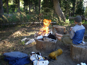
Supper Time
Looking South at Man Peak
Lush and green, even in September
Wild and Rugged
Miles of trail-less ridge walking
Cooling off soar feet
Camp 2
Heading North to Prater Mountain
Map Check
Amy scopes the final miles to Mount Stewart and the end of our traverse
Over three long days we walked approximately 55 rugged miles: about a third on maintained Forest Service trails, a third along deer trails, and the remaining third trail-less scrambling. In total we ascended over 18,500 feet and rarely dropped below 9,000 feet.
— route
Salt River Range


Looks like gorgeous country.
ReplyDeleteWhy CiloGear (30L W/NW?) packs rather than your usual HMG porter? I don't see any ice axes or technical climbing. Why carry the extra ~2 oz. of weight?
The traverse was done two years ago right before we got our first HMG Packs.
DeleteDamn. I want mountains! Well, at least I'll get some hills, rivers and proper wilderness the next weerk. :)
ReplyDeleteMax: I was thinking the same. Would this explain it? "During Labor Day Weekend, 2011 - -"
Wow,so beautiful! My husband and I hike but the are only day hikes. Been to Prater 3 times, Viser Peak. Elk Mountain lookout, Wyoming Peak, Crow Creek Lakes, Coral Lake. Hoping to hike Covey this year but smoke is already setting in. Also Wagner Lake and be part of it Middle Ridge up Grey's. I would love to see more pictures.
ReplyDeleteHello Forrest and THANK YOU SO MUCH for all the effort and time you have put into your site. We have done a number of the packrafting routes you have suggested around Jackson and have loved everyone. Those memories most likely would have never happened without your guidance. It was also so cool to read over your mountaineering resume, beyond impressive. The reason I'm writing is to hopefully get some more info on this Salt River Traverse. My wife and I are hoping to do this route over the 4th of July weekend. Do you think this is too early? We were in the Snake River Range this weekend on Mt. Baird and it was melted out enough and we looked over the the Salts and there is definitely snow but looked passable. Another question: is the starting trailhead accessible for an AWD subaru crosstrek or is 4X4 needed for smiths fork rd? Sorry one last question: is it possible to get a higher resolution image of the route, so we could follow your line? Thanks again, Ryan
ReplyDelete